Angl fuses live USGS flows, NOAA weather, snowpack and flood data into a single Go / Marginal / Blown verdict for every western river — so you stop refreshing gauge charts and start fishing.
Angl reads the same data the guides read — flow vs. its seasonal band, water temp, clarity, trend and safety — then commits to a call. No dashboards to interpret.
Flow sits in its productive band, water's cool, clarity's clean and the trend is steady. Grab the rod.
A little high, off-color or warming. Angl tells you why so you can pick the right water and hours.
Runoff, a spike or a thermal risk. See it from the couch instead of the boat ramp.
Three taps between opening the app and knowing exactly where — and when — to fish.

Browse by state or tap "Near Me." Every river is color-coded before you even open it.

Live flow, temp, clarity and gage height — with a one-line reason for the call and the typical band.

Solunar windows, first/last light and a 7-day flow forecast tell you the hour to be standing in the river.
Everything the pro apps charge for — flows, maps, forecasts, safety — fused from free public data.
A 45-day sparkline over each river's own typical band, live gage height in feet, plus a 10-year historical range so today's number actually means something. Toggle cfs or feet, and drop a personal reference line — your wading limit, your favorite level.

Major & minor feeding windows, dawn and dusk light — the hours that actually fish.
Satellite, daily true-color imagery and live NEXRAD radar, with public access, boat ramps and fly shops pinned.
Set a flow, level, temp or clarity threshold and Angl flags the moment your river hits it.
Flood-stage banners, thermal-stress warnings for the trout, and a link to the state's official rules.
NWS river forecasts show where the flow is heading over the next 7 days — plan the weekend early.
Every river's drop in ft/mile and elevation range — read the character of the water before you scout it.
Pick put-in and take-out from mapped access sites, then log your outing — Angl saves the conditions so next time it can tell you "your fish come at ~1,500 cfs."

The same feeds hydrologists and biologists rely on — read for you, every few minutes, and turned into a verdict.
Open any spot and everything you'd stitch together from five websites is already there — scrolling by, live.
"GO · 0.74 — runoff past, snowpack gone, settled summer flow."
Flow, water temp and wind, each drawn against the band that fishes well here.
NWS forecast, 10-year historical range and the solunar windows for today.
Favorite it, set a GO alert, log the day, or file a guide report for the community.
Swipe through the app — real screens, real live data from a Montana tailwater.


Reading a river is always free. Pro unlocks every water and the planning tools that save the drive.
Yes — reading flagship rivers, their verdicts, conditions, maps and best-times is free forever. Angl Pro unlocks every water plus alerts and planning tools. Beta testers get everything unlocked.
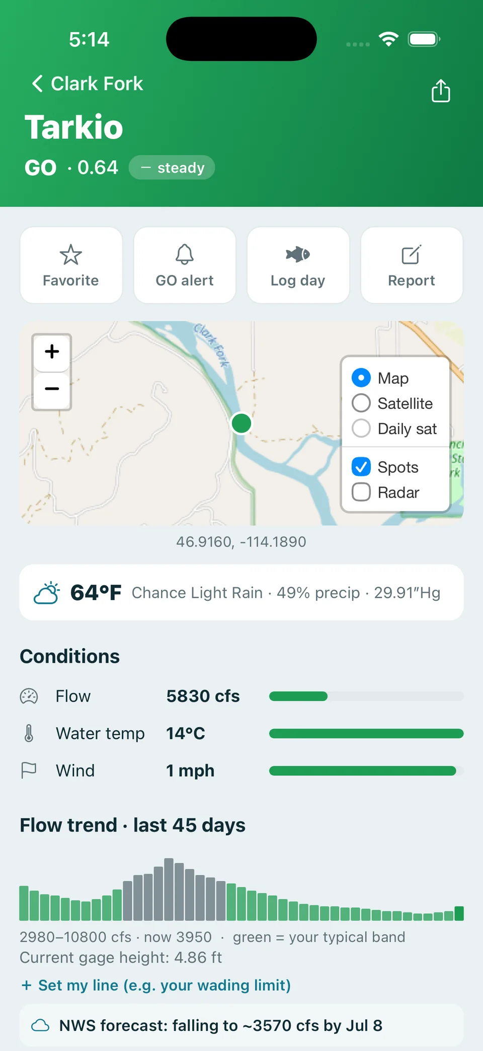
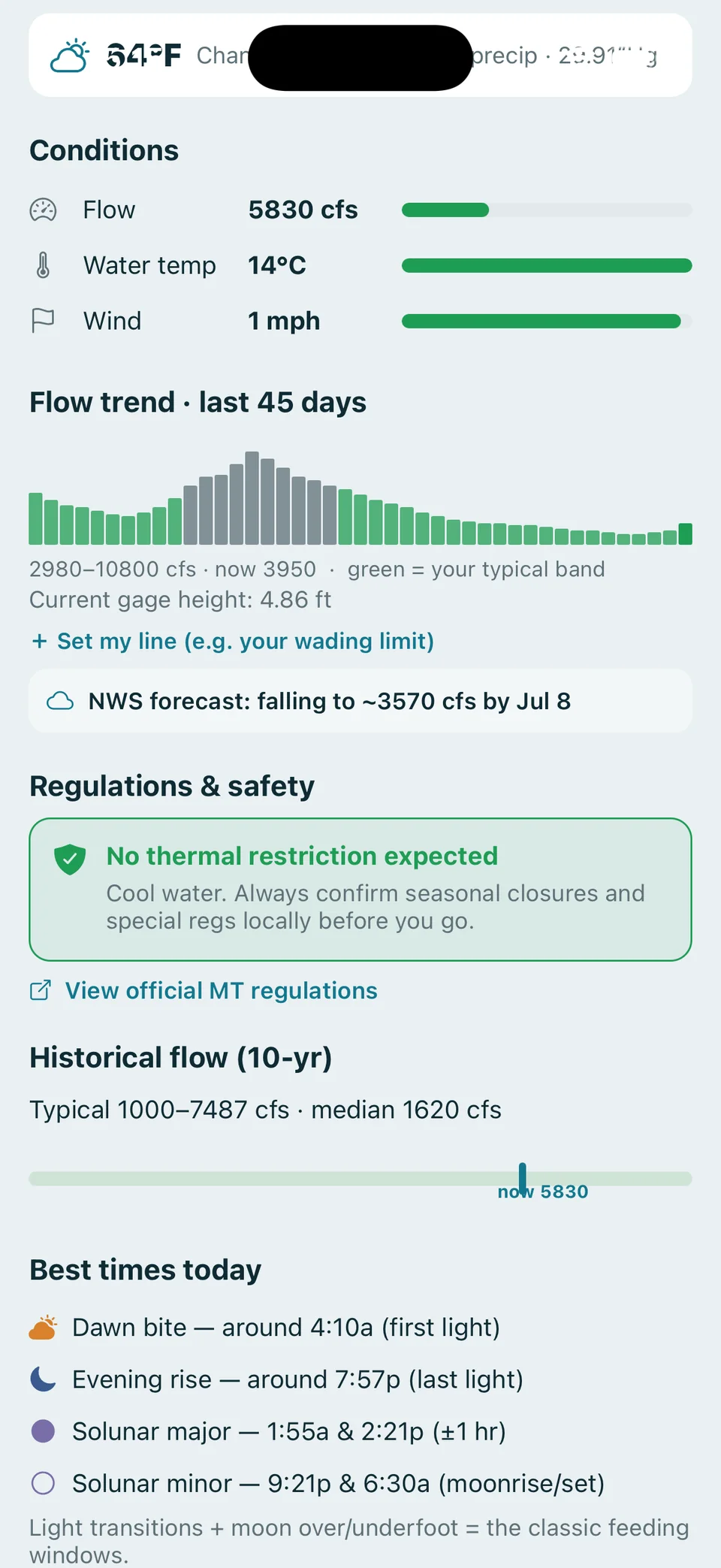
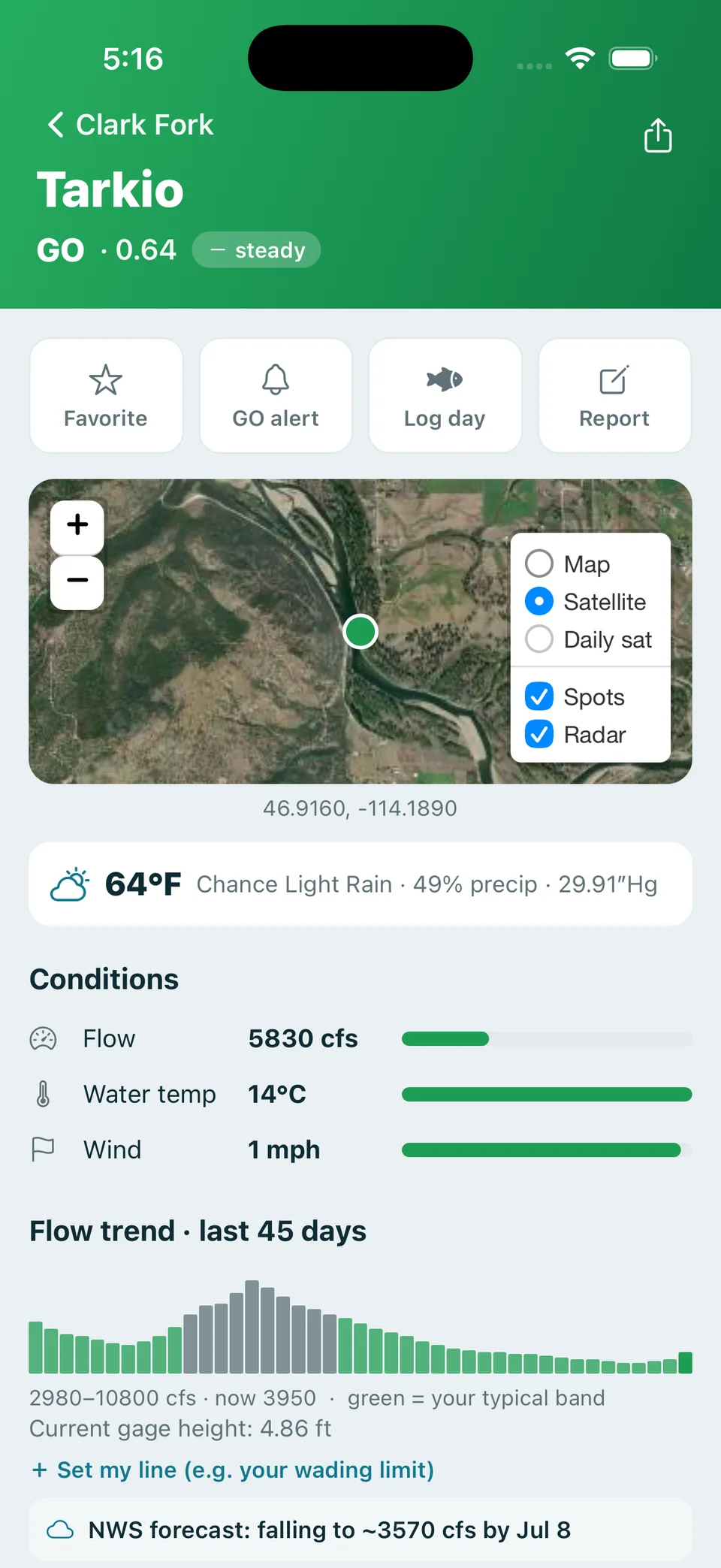
100% public sources: USGS (flow, temp, gage height), NOAA/NWS (weather & pressure), NWPS (river forecasts & flood stage), USDM (drought), NRCS SNOTEL (snowpack) and USGS 3DEP (elevation). No paywalled feeds — Angl just reads them for you and turns them into a verdict.
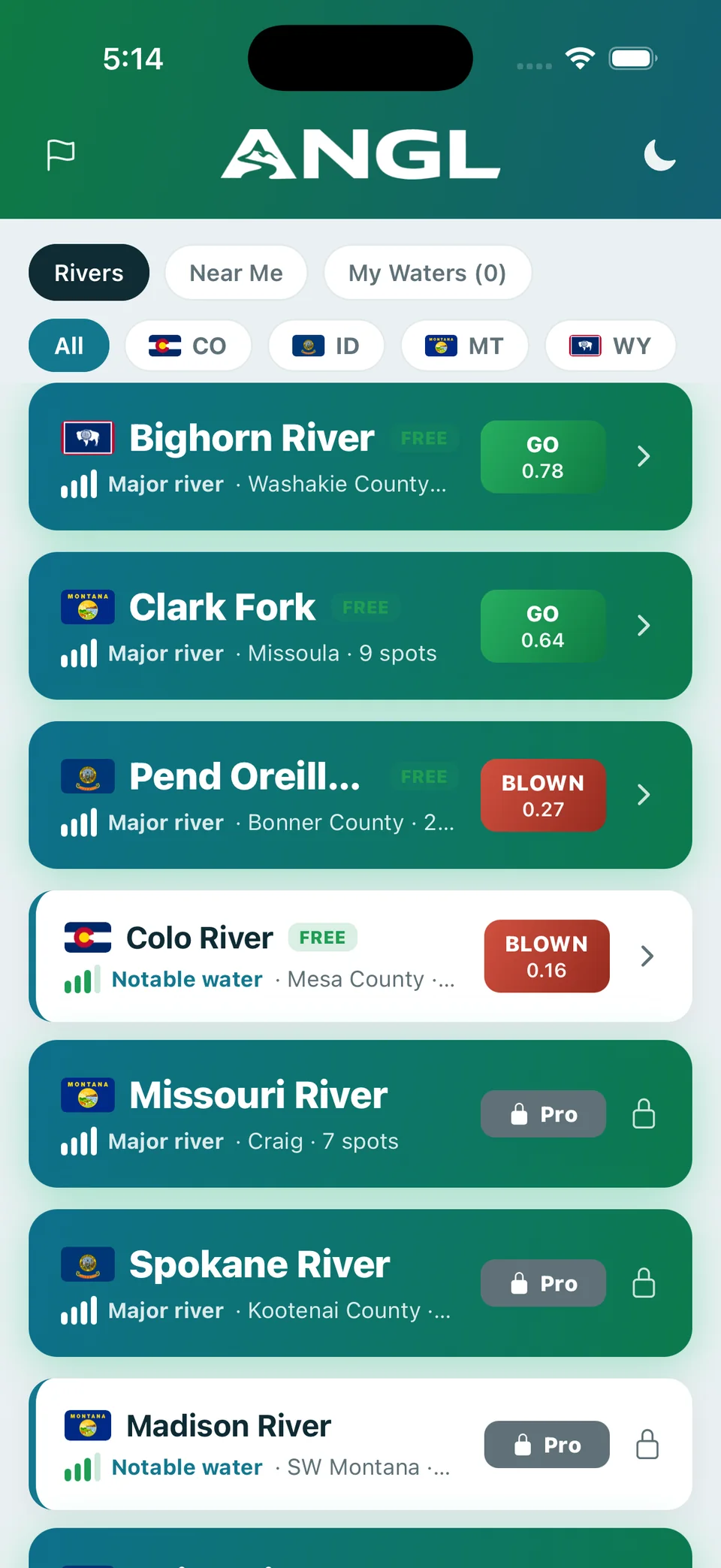
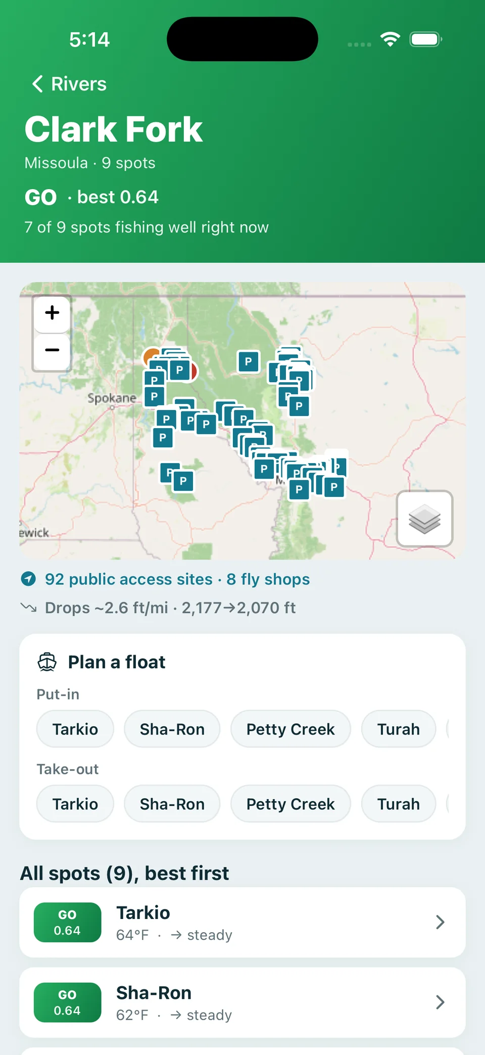
The western US to start — Montana, Idaho, Colorado, Wyoming and expanding — with 229 spots scored today and more added regularly. Any river with a public USGS gauge is fair game.
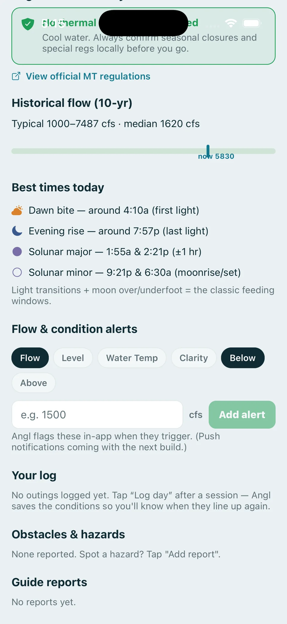
Verdicts are built from live gauge and weather data updated continuously, weighed against each river's own seasonal band. It's decision support, not a guarantee — always confirm local regulations, closures and safety before you fish.
iOS comes first — the TestFlight beta is live now. Android is on the roadmap.
Angl is in TestFlight beta today. A public App Store release lands with launch — join the beta to get it first and help shape it.
Join the TestFlight beta and get every western river's verdict in your pocket this season.
Request a beta invite →